
$578,000
8615 Old Kamloops Road
Stump Lake94 days on market
listed by Keller Williams Bold Realty
MLS® 10395811

Stump Lake · MLS® 10400959
2.05 acres lot · Land · Vacant Land · 41 days on market
listed by Richard Burnett, Brendan Shaw Real Estate Ltd.
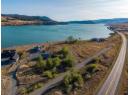
Lakefront Living at Its Best – 2 Acre Lot on Stump Lake - Discover the perfect setting for your dream lakefront home on this beautiful 2-acre flat lot situated right on the water at scenic Stump Lake, BC. Ideally located between Merritt and Kamloops, this property offers the ideal balance of peaceful rural living with convenient access to nearby amenities. This rare offering is part of a well-managed bareland strata with a low monthly fee of $160, which includes community water (water and electricity ready to go at the lot), making ownership simple and stress-free. With ample flat land, you’ll have endless options for designing and building your ideal lakefront retreat, whether that’s a year-round residence or a recreational getaway. Enjoy stunning lake views, easy access to the water, and the serenity of nature right outside your door. Stump Lake is known for its quiet beauty, great fishing, and relaxed lifestyle, perfect for those seeking a true escape. The lakeshore is very accessible with low bank frontage. This property is well set up for boats and other toys to hit the lake.
20% down at 4.34% fixed (Ratehub.ca), 25 years; tax from the listing; strata fee from the listing.
Keep private notes and ratings on homes you're considering. (email only) and they follow you to every device.
Homes in Stump Lake. Sale prices register 1 to 3 months after a sale closes.
This address is inside the Agricultural Land Reserve. ALR land is set aside for farming; building, subdividing and non-farm uses follow Agricultural Land Commission rules.
The BC Wildfire Service rates Stump Lake_148's wildland urban interface as risk class 1 of 5 (the highest class). 4 wildfires of 10 hectares or more burned within 5 km since 2006: 2023 (11.4k ha), 2021 (57 ha), 2015 (166 ha), 2009 (50 ha). Some insurers price for wildfire, and FireSmart BC has a free home assessment guide.
Source: BC Wildfire Service, WUI risk class and fire perimeters
From public government maps, matched to the listing's map pin. Maps can be out of date or miss a lot line; confirm with the municipality.
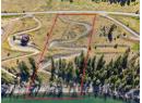
lot outline: 8,281 m² (89,136 sq ft) · PID 024-647-021. from ParcelMap BC; property lines are approximate, a survey is the legal boundary.
Walkability 0/100 · Car needed for most errands
Nothing everyday within a 10 minute walk.
mihom score from OpenStreetMap places, by straight line distance.