3799 Otter Point Rd
$6,999,900
3799 Otter Point Rd
Otter Point, Sooke · MLS® 1048072
6
559 acres lot · Land · Vacant Land · 63 days on market
listed by Marlene Arden, RE/MAX Camosun
realtor's description
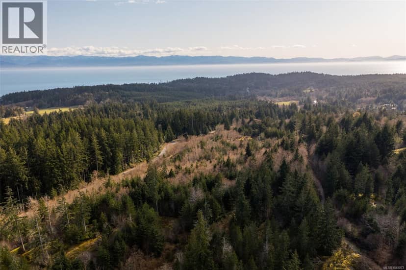
Beautiful West Coast Property! 558.86 Acres of pristine West Coast land just west of Sooke on Vancouver Island and an hours drive to Victoria. 8 separate titles with lots of potential. OCP supports smaller lot sizes than currently zoned for. Currently Zoned Rural A and RR3. Absolutely beautiful! The lands run behind existing roads making access throughout lands to Otter Point Road possible with multiple exit points-diverse range of development potential. This exceptional property offers stunning ocean and mountain views. Whether you're looking to invest, develop, or secure a legacy property, this site is unmatched in size, setting, and long-term potential. Call for information.
property details
- type
- Land, Vacant Land
- lot
- 559 acres
- parking
- 6
- property tax
- $10,059 / yr
- days on market
- 63
- MLS®
- 1048072
features
- Acreage
- Wooded area
- Irregular lot size
- Sloping
monthly cost
$31,646/mo
Mortgage $30,808 · Tax $838
20% down at 4.44% fixed (Ratehub.ca), 25 years; tax from the listing.
schools
Catchment schools, Sooke School District 62
- Elementary John Muir Elementaryhomes in this catchment
3.8 km away · PO Box 790, Sooke · 250-642-5427
- Middle Journey Middle Schoolhomes in this catchment
5.8 km away · PO Box 100, Sooke · 250-642-5881
- Secondary Edward Milne Community Schoolhomes in this catchment
7.3 km away · PO Box 1010, Sooke · 250-642-5211
From the Sooke School District 62's published catchment maps. A catchment gives priority, not a guaranteed seat, and French immersion and choice programs work differently. The district confirms catchment: check with its school locator.
Keep private notes and ratings on homes you're considering. (email only) and they follow you to every device.