567 Windthrop Rd
$5,000,000
567 Windthrop Rd
Latoria, Colwood · MLS® 1050559
3.9 acres lot · Land · Vacant Land · 36 days on market
listed by Matt Peulen, RE/MAX Camosun
realtor's description
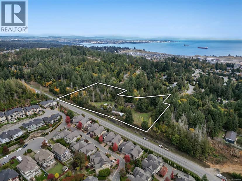
DEVELOPMENT OPPORTUNITY: Discover 3.90 acres of prime development land. The property is within the Neighbourhood Hillside & Shoreline Land Use Designation, a strategic designation that paves the way for increased density and Low-Rise buildings, up to 6 storeys. Surrounded by multi-family zoned properties, it stands as a prime example of the region's potential for higher density development, growth, and prosperity. The options for redevelopment are vast, making it an attractive investment in a thriving community. This expansive parcel currently includes a 3-bedroom home, a workshop, and various outbuildings for potential rental revenue.
property details
- type
- Land, Vacant Land
- lot
- 3.9 acres
- parking
- 0
- property tax
- $1,859 / yr
- days on market
- 36
- MLS®
- 1050559
features
- Acreage
- Park setting
- Private setting
- Irregular lot size
- Other
monthly cost
$22,161/mo
Mortgage $22,006 · Tax $155
20% down at 4.44% fixed (Ratehub.ca), 25 years; tax from the listing.
schools
Catchment schools, Sooke School District 62
- Elementary Wishart Elementaryhomes in this catchment
1.5 km away · 3310 Wishart Rd, Victoria · 250-478-9528
- Middle Dunsmuir Middle Schoolhomes in this catchment
1.7 km away · 3341 Painter Rd, Victoria · 250-478-5548
- Secondary Ecole Royal Bay Secondaryhomes in this catchment
From the Sooke School District 62's published catchment maps. A catchment gives priority, not a guaranteed seat, and French immersion and choice programs work differently. The district confirms catchment: check with its school locator.
Keep private notes and ratings on homes you're considering. (email only) and they follow you to every device.