$8,980,000
12581 16 Avenue
Surrey21 days on market
listed by Sutton Group-West Coast Realty (Surrey/24)
MLS® R3171908
Surrey · MLS® R3172611
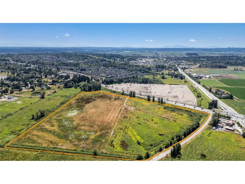
2,946,572 sq ft lot · Land · Vacant Land · 19 days on market
listed by Bryan van Hoepen, Real Broker BC Ltd
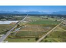
Excellent opportunity to acquire approximately 67 acres in a highly visible Fraser Highway location in Cloverdale. This substantial A1-zoned parcel offers excellent road access, southwest exposure and convenient connections throughout Surrey and Langley. The property is also well positioned near the new Surrey-Langley SkyTrain extension currently under construction along Fraser Highway, with service anticipated to begin in late 2029. The property is serviced by a drilled well, with electricity available and natural gas, telephone and cable services nearby. A rare opportunity to secure a large Fraser Highway holding in a rapidly evolving area with strong long-term potential, subject to applicable zoning and approvals.
20% down at 4.34% fixed (Ratehub.ca), 25 years; tax from the listing.
Catchment schools, Surrey School District 36
1.6 km away · 18711 74 Ave, Surrey · 604-595-6488
1000 m away · 7278 184 St, Surrey · 604-235-9836
From the Surrey School District 36's published catchment maps. A catchment gives priority, not a guaranteed seat, and French immersion and choice programs work differently. The district confirms catchment: check with its school locator.
Keep private notes and ratings on homes you're considering. (email only) and they follow you to every device.
| year | assessed | est. tax |
|---|---|---|
| 2026 | $7,373,000 | $25,270 |
The listing shows $19,978 a year in property tax.
Estimate: the BC Assessment value times Surrey's residential tax rate for that year (Province of BC, local government statistics). Leaves out the home owner grant, parcel taxes and utility charges; the city's tax notice is the real figure.
Rezoning for a 6 storey, 713 unit building
330 m away · 2023 · concluded
Rezoning from Acreage Residential Zone (RA) to Comprehensive Development Zone (CD); Subdivision from four (4) lots into two (2) lots; Official Community Plan (OCP) Amendment from Urban to Multiple Residential; Neighbourhood Concept Plan (NCP) Amendment from Townhouse Residential (22 + 5 upa) to Low Rise Residential; General Development Permit to allow the development of seven 6-storey apartment bu
Applications filed with the city, active or decided in the last 3 years, measured from the listing's map pin. An application isn't an approval; the city's page has the current details. Source: City of Surrey development applications.
Homes in Surrey. Sale prices register 1 to 3 months after a sale closes.
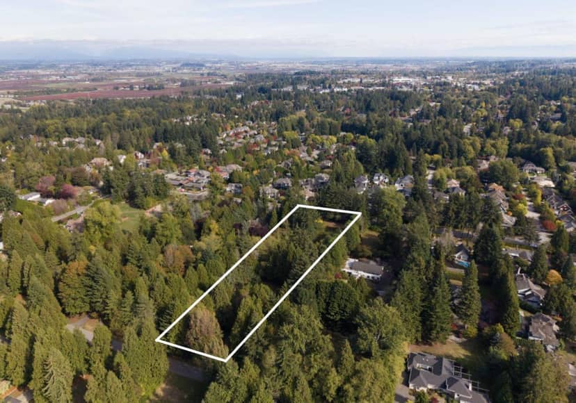
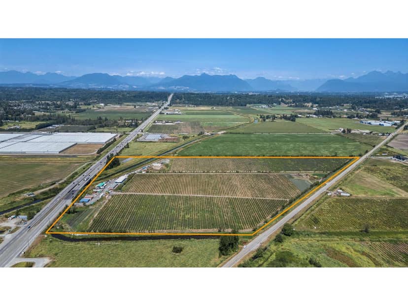
lot outline: 274,193 m² (2,951,386 sq ft) · PID 001-124-528. from ParcelMap BC; property lines are approximate, a survey is the legal boundary.
Walkability 21/100 · Mostly by car
Within a 10 minute walk: 4 parks and playgrounds, 1 transit stop.
mihom score from OpenStreetMap places, by straight line distance.
This address is inside the Agricultural Land Reserve. ALR land is set aside for farming; building, subdividing and non-farm uses follow Agricultural Land Commission rules.
From public government maps, matched to the listing's map pin. Maps can be out of date or miss a lot line; confirm with the municipality.