
open houseHouse
$1,599,999
5929 140B Street
Surreylisted today
listed by Coldwell Banker Universe Realty
MLS® R3178431

Surrey · MLS® R3177335
6410
2,892 sq ft · 30,509 sq ft lot · House · Single Family · built 1964 · 5 days on market
listed by Harpal S. Lehal, Century 21 Coastal Realty Ltd.
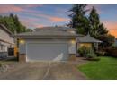
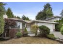
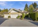
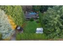
Best-Priced 0.7-Acre Townhome Development Opportunity! Exceptional investment, holding & development property designated for up to 30 units per acre under the approved South Newton NCP. Rare 0.70-acre (30,509 SF) flat, usable lot in the heart of East Newton, with all City services at the lot line. Excellent location close to transit, schools, shopping & amenities, with easy access to King George Blvd & Hwy 10. Convenient bus access to King George SkyTrain Station. Features a solid, well-maintained character rancher, ample parking & $6,050/month rental income. Neighbouring owners to the south are willing to sell or cooperate in a joint development, offering added potential. Property contains unauthorized accommodations. TRY ALL OFFERS!OFFERS!
| year | assessed | est. tax |
|---|---|---|
| 2026 | $1,840,100 | $6,307 |
The listing shows $10,737 a year in property tax.
Estimate: the BC Assessment value times Surrey's residential tax rate for that year (Province of BC, local government statistics). Leaves out the home owner grant, parcel taxes and utility charges; the city's tax notice is the real figure.
20% down at 4.34% fixed (Ratehub.ca), 25 years; tax from the listing.
Catchment schools, Surrey School District 36
600 m away · 6677 140 St, Surrey · 604-543-9347
3.0 km away · 6016 152 St, Surrey · 604-597-1977
From the Surrey School District 36's published catchment maps. A catchment gives priority, not a guaranteed seat, and French immersion and choice programs work differently. The district confirms catchment: check with its school locator.
Keep private notes and ratings on homes you're considering. (email only) and they follow you to every device.
Development permit for 24 homes
330 m away · 2024 · under review
Development Permit to construct an additional motel building (1 235 sq.m) containing 24 units within a Sensitive Ecosystems (streamside) and Hazard Lands (steep slope) DP area.
Rezoning for a 2 storey building
380 m away · 2026 · under review
Rezoning from CD (BL10667 ) to CD (Based on C-8) Development Permit for the construction of a two-storey 7 425.38 sqm retail commercial and office building including a SEDP (streamside areas) and Hazard Lands Development Permit (steep slope areas) and a Development Variance Permit (DVP) to vary setback requirements.
210 m away · 2023 · concluded
Rezoning from Acreage Residential Zone (RA) to Compact Residential Zone (R5); Subdivision from one (1) lot into two (2) single family lots.
210 m away · 2023 · under review
NCP Amendment Townhouses (15 upa max) Creeks and Riparian Setbacks and Buffers to Townhouses (25 upa max) Creeks and Riparian Setbacks and Buffers Development Variance Permit for building and parking setbacks Rezoning from RA to RM-30 and a Development Permit to construct twenty-nine (29) townhouse units.
330 m away · 2025 · concluded
Rezoning from Urban Residential Zone (R3) to Comprehensive Development Zone (CD) (based on Child Care Zone (CCR) to permit a standalone child care centre limited to 24 children and 4 staff.
Applications filed with the city, active or decided in the last 3 years, measured from the listing's map pin. An application isn't an approval; the city's page has the current details. Source: City of Surrey development applications.


lot outline: 2,837 m² (30,537 sq ft) · PID 007-324-766. from ParcelMap BC; property lines are approximate, a survey is the legal boundary.
Walkability 55/100 · Somewhat walkable: some errands on foot
Within a 10 minute walk: 3 places to eat or drink, 10 parks and playgrounds, 1 school, 11 transit stops.
mihom score from OpenStreetMap places, by straight line distance.
Houses in Surrey. Sale prices register 1 to 3 months after a sale closes.