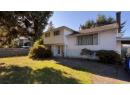

$1,039,999
29 7788 Ash Street
Richmondlisted today
listed by Luxmore Realty
MLS® R3178594

Richmond · MLS® R3178208
314
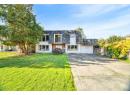
1,578 sq ft · 7,324 sq ft lot · House · Single Family · built 1959 · 3 days on market
listed by Shafik Ladha, RE/MAX Westcoast
Located in a quiet family neighborhood, this 1,578 sq. ft. traditional 3-level split sits on a 7,324 sq. ft. lot with back lane access in Ironwood and is ready for its next chapter. Offering excellent potential for multi-generational living or future multiplex redevelopment. Quiet yet convenient location close to transit, parks and all levels of schools, with easy access to Ironwood Plaza and Hwy 99 connecting you to Vancouver, Ladner, Tsawwassen and Surrey. A great opportunity to renovate, rebuild or bring your own vision to life!
20% down at 4.34% fixed (Ratehub.ca), 25 years; tax from the listing.
Catchment schools, Richmond School District 38
| year | assessed | est. tax |
|---|---|---|
| 2026 | $1,522,300 | $5,386 |
The listing shows $5,272 a year in property tax.
Estimate: the BC Assessment value times Richmond's residential tax rate for that year (Province of BC, local government statistics). Leaves out the home owner grant, parcel taxes and utility charges; the city's tax notice is the real figure.
400 m away · 10300 Seacote Rd, Richmond · 604-668-6296
1.1 km away · 9500 No. 4 Rd, Richmond · 604-668-6575
From the Richmond School District 38's published catchment maps. A catchment gives priority, not a guaranteed seat, and French immersion and choice programs work differently. The district confirms catchment: check with its school locator.
Keep private notes and ratings on homes you're considering. (email only) and they follow you to every device.


Houses in Richmond. Sale prices register 1 to 3 months after a sale closes.
lot outline: 680 m² (7,319 sq ft) · PID 010-575-146. from ParcelMap BC; property lines are approximate, a survey is the legal boundary.
Walkability 86/100 · Very walkable: most errands on foot
Within a 10 minute walk: 3 grocery stores, 14 places to eat or drink, 2 cafes, 8 parks and playgrounds, 2 schools, 16 transit stops.
mihom score from OpenStreetMap places, by straight line distance.
The BC Wildfire Service rates Vancouver's wildland urban interface as risk class 5 of 5 (lowest; 1 is the highest). One wildfire of 10 hectares or more burned within 5 km since 2006: 2018 (13 ha). Some insurers price for wildfire, and FireSmart BC has a free home assessment guide.
Source: BC Wildfire Service, WUI risk class and fire perimeters
From public government maps, matched to the listing's map pin. Maps can be out of date or miss a lot line; confirm with the municipality.